Tuesday and Wednesday July 29-30th 2008
We left Von Donup Inlet with WindDancer and headed north towards Hole in the Wall Passage. We had to time this just right due to the currents that flowed through here with the tides. We did not have that far to go and the wind was behind us, so we sailed most of  the way there.
This also marks the furthest Spot north and the furthest from home that we would be on this trip.
We got there a little faster than we thought we would, so we had to circle around just shy of the Passage for about an hour. We watched a few power boats muscle their way against the current. They were really fighting it, so we decided to hang back a bit longer. WindDancer nosed up to it but circled back, on thier second attempt we headed through ourselves.
There were no rapids like the entrance to Princess Louisa Inlet. But the current gets pretty heavy, something like 8 or 9 knots. It’s not as narrow either, but still it’s always a little nerve racking going through passages like these for the first time.
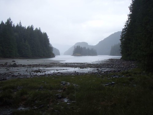
Once we got through, we only had another mile to go to our anchorage in the Octopus Islands. These islands were very cool. Today also marked the start of the rains that would hang around for 3 days or so.
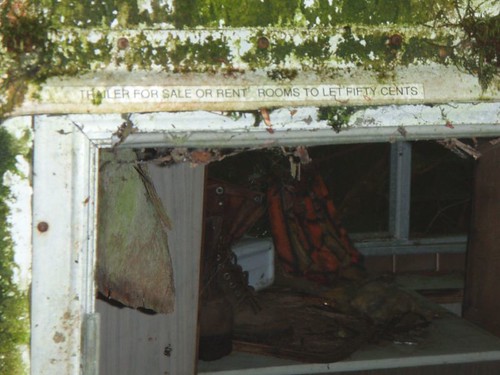
On Wednesday we decided to go for a hike. The first place we stopped at looked like it might be cool to explore, but other than an old torn down cabin and a slightly less old camper that looked like the scene of serial killing, we did’nt find much else of interest.
When we got to the head of the bay, it was raining and it was low tide. We did not feel like dragging the dinghy all the way up to the high tide mark. So we tied it to a short cliff on shore. We scrambled along the rocks for about 200 yards trying to stay out of the muck of low tide. Originally we had only planned on taking a short hike over land to another bay called Small Bay. The trail there was well marked and an easy hike. Actually it was a little too easy. So we decided to continue hiking, despite the rain. From looking at the map before leaving the boat we saw a lake that was supposed to be really good for swimming.
Once we left Small Bay and headed up hill towards the lake. The hike got a little harder, but not too bad. It was only 2 or so. Once there, the one good swim spot was taken up by some hikers that had come from the other direction from their car. They had a very cute, but insanely annoying dog. So we decide to hike on to find another rock to swim off of.
The water in this lake was not the warmest lake we’d swam in, but it was impossibly clear. The rain stopped just as we got to the rock and the sun came out.
The hike back was uneventful, however, once we got back to where we left the dinghy, we got a bit of a surprise. Since we were gone alot longer than we had planned the tide had come completely in. And we now had 200 yards of water between us and our dinghy that was tied to a small cliff in 1 foot of water and we could walk to the spot we now stood. But since the tide had come in, The dinghy was still tied to that same cliff, but was in 8 feet of water and the mud we had walked on was now 6 feet under water.
We had to climb along this cliff to get to the dinghy, not a bit deal, but I’m sure the people anchored out had a good laugh watching us climb out to get out dinghy.
About half way back to the boat the rain started again and did’nt stop for awhile. The storm that blew through was a doozy. A tree was struck by lightening about 100 yard away from our boat. Talk about loud and bright. We took the rain as a chance to work on our scrabble skills and reading. We also checked out tide pools and did some exploring by dinghy till we left.