Big trip to Canada Day 15 (CB)

Saturday 26 July 2008

We did’nt have very far to go today, so there was no real rush to get going all that early, plus we had to pickup the fresh cinnimon rolls we had ordered last night. They were very tasty! It was a little over cast this morning, but no rain. And as has been the case more times than not, no wind either. We motored north towards Teakern Arm with a final destination of Cassel Falls.

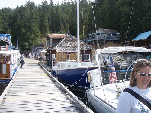
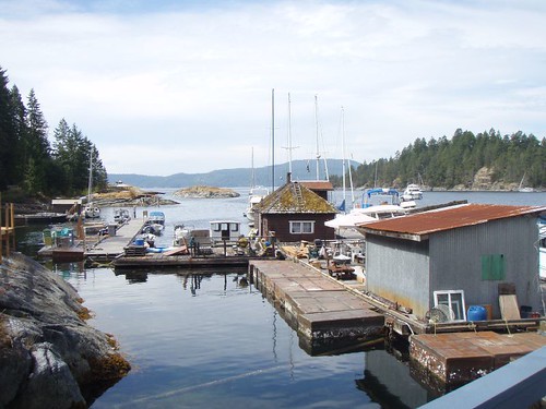
The scenery up here seems be getting wilder, if that makes sense. Probably just seems wilder due to the fact that there are less and less people, houses, boats…. The further north you go the less you seen signs of civilization. Which is very cool with us.

We did pass a tug boat pulling a freakin GIGANTIC boom of logs from some timber operation even further north. And as we turned into Teakerne Arm and made our way to the end, you could see huge log booms tied up to cliffs. The guide books say that tieing along side them is fine. And we did see one boat doing just that. But I could not see us doing it. Not so much cause it seem dangerous, but more becuase the tug boats that haul these things will show up when ever and unhook them and tug them south to the lumber mills. And I would hate to be woken up in the middle of the night to the sound of a tug boat and blaring lights and have to move spots.

So we continued on up Teakerne Arm till we found the area near Cassel Falls. There are a few little coves to stern tie in. Although call them coves is giving them a little to much credit. The spot we found was barely more that a small curve in the shoreline. But it worked just fine for us.

One we got settled in we hopped in the dinghy and headed for the water fall. Oh and we fired up the video camara to film the high speed approach.

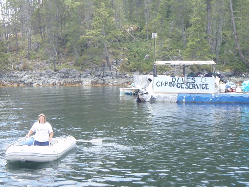
The really cool thing about this water fall is, you’ll notice that it is set back in a sort of canyon. Along the walls of this canyon are a couple log boom rings. These have been here for years, but people will back their boat in this little canyon and tie thier boat in here. It’s actually to deep to anchor. So your just being held in place by four lines tied to the log boom rings in the cliff walls. A boat did it while we were there, but we did not think to take a picture of it.

This water fall was awesome, and super warm water. It was actual really warm water, but hurt like hell standing underneath it.

**WARNING** The following video contains pasty white boy with a beer belly **WARNING**

Actually, when I watch that video i’m reminded of that Bigfoot video for some reason??

After that little adventure we headed over to the marine park dinghy/float plane dock and followed the trail up to Cassel Lake. With the waterfall being that warm, the lake was even warmer and really clear. We did a little cliff diving and swam around a bit before heading back to the boat.

As we were getting ready to go to bed it started to rain. First time since we left, not bad for the PNW. It was not a lot of rain, but I went up on deck to just hangout and chill for a bit. It was insanely dark, but the rain drops were hitting the water and causing the bioluminescence to flash.

If you don’t know what bioluminescence is. It is basically, light that is created by a living thing. The thing most of you might know it as is the light that a lighting bug makes. But in this case the light is a light blue color and is created by billions and billions of little cells that hang out in the saltwater. And when they are disturbed, either by a fish swimming, splashing an oar in water, or like tonight the rain hitting the waters surface, they give off a spooky blue glow for a few seconds. It really is one of the coolest things you can witness. It happens more in the summer months than any other time of year. I guess that is due to the water tempature.

Posted in Big trips, Canada Trip, CB, Maps, Palarran, videos | Leave a comment

Big Trip to Canada Day 14 (CB)

Friday 25 July 2008

MAP of trip.

We left Roscoe Bay on a rising tide, so we could get out over the bar at the entrance of the bay. Once out of the bay we tried to do a bit of sailing, but there was not a lot of wind. Actually, the wind started out not too bad, but quickly died to nothing.

Our final destination today was Squirrel Cove. But first we planned to stop off in Refuge Cove to pickup some supplies (Fresh veggies, Beer & Ice).

As we rounded Hope Point and entered Refuge Cove, the first thing that entered my mind was that old ’80s Robin Williams movie “Popeye”.Remember how that town looked? All the shacks built up aroun the waterfront. That is exaclty how Refuge Cove looked to me as we motored up to the docks.

We loaded up on fresh veggies and beer at the store. Had lunch at a little cafe up one of the boardwalks. This little outpost has a pretty sweet operation going. They pretty much provide all the boaters with just about everything you need to resupply while up here. Of course the prices reflect that, but not to bad.

So with the fridge and beer cooler topped off and our tummys full, we just had one more mission to accomplish. And this one is usually the hardest. We had a bag of garbage to get rid of. I fully realize that this does not really sound like a big deal, much less warrant the title of mission. But trust me, when cruising it usually turns in to a mission. Mostly due to the fact that anywhere that there may be a dumpster, you have to pay to use it or it’s locked up. This of course is due to the fact that somebody has to pay to have it hauled away.

Fortunatly for us, here in Refuge Cove there is a guy named Dave that will take your recycleables for free and charge you a nominal fee to take the rest of your garbage.

How do I know his name is Dave you ask? See below:

Prior to leaving Seattle we had planned for the difficulties of getting rid of garbage by unpackaging most of our supplies and getting rid of a crap load of cardboard boxes and plastic bags and shit. It was actually amazing how much extra crap there is in a months worth of groceries.

So with that out of the way and after Tawn rowed back to the boat. We headed over to Squirrel Cove. It was only 3 or 4 miles from Refuge Cove to Squirrel Cove. We were over there and anchored by 1pm.

As we pulled into Squirrel Cove we spotted Ghost anchored over near a small island. We motored around and found a little spot of our own to anchor. No need to stern tie here. Just a regular old anchorage.

An added bonus of where we anchored was a small, small floating blue house, that turned out to be a floating bakery….mmmmmmm! There was a closed sign on the door when we dinghied over. But the sign assured us they would be open again at 4pm to take orders for fresh cinniamon rolls and pies, that would be hot fresh and ready for pickup in the morning! So with a couple hours to kill we decided to head over to the Community of Squirrel Cove.

The main reason we went here was that while we were in Refuge Cove, I forgot to get fuel for the dinghy. We also stopped at the little store and got some bacon and licorice….both of which were total impulse buys. But who can say no to bacon? Not I! And as it turns out the prices at this store were alot cheaper than at Refuge Cove, but live and learn.

Now back to that little floating bakery.

The little blue building is the bakery, and the old beat down building to the left is the orginal bakery that has seen better days. We stopped and talked to the little old lady that runs/owns the bakery. She lives on the other side of the island and stays here in the bakery during the summer months. She takes bakery orders from 4pm till 8pm, then gets up ass early and starts baking so everything is ready to go around 8am for pickup. We ordered a couple cinnamon rolls from here. Ghost got a pumpkin pie. It was all very good. Doubly so, just due to the fact that it all comes from this super nice lady in her little floating house.

With our orders placed, we headed over to see what ghost was up to, and made plans to have a bonfire on shore. Scotty promised to make “hobos” on the campfire for dinner. After establishing we weren’t going to be killing and eating homeless people for dinner, we set about gathering firewood for the cookout.

We only spent the one day here in Squirrel Cove. Tommorow we break off from Ghost again and head north to Teakerne Arm.

Posted in Adventures, Big trips, Canada Trip, CB, Maps, Palarran | Leave a comment

Big Trip to Canada. Days 9 – 10 (CB)

Monday & Tuesday July 21 & 22:

The next couple of days in Tenedos Bay were spent alot like the days in Princess Louisa Inlet. Lots of hiking, swimming and exploring via dinghy. We also did some crabbing/Shrimping.

As usual, you can follow along on the MAP.

Directly behind the spot were Palarran was anchored was a couple hundred foot tall cliff. From the cockpit of the boat it looked like there was a spot or two on top of which we could get some really cool pictures both the bay and the boat. With that as a plan we took the dinghy ashore and tied it up. There was no trail to follow so we started bush whacking our way up the hill. The first thing that became evident was the fact that we should have worn pants. Our legs are still healing from some of the scratches we got on that hike. But after an hour or so of scrambling and climbing we made it to the top of the cliff. And we were rewarded with a pretty awesome view of the bay below and some really cool pictures of Palarran.

This picture was taken almost near the top of the cliff looking southwest. The opening in the upper far right if the photo is where we came in the day before.

Ghost and WindDancer would be coming a few hours after that photo was taken, they ended up anchoring in the southeast corner of the bay, which is to the left and around the corner. That is the spot we had planned on anchoring when we came in but there was no room at the time.

You cannot see our boat in the picture above, we had to climb about 20 feet higher to the top of a outcropping that we could see out over the edge of in order to see Palarran.

We took a number of photos from up here, but I think these two are the best:


The trip down had one little bonus that we did not count on. Hornets! God damn, those little bastards are mean. We had the hardest part of the climb down behind us. The only bit left was to make sure we found the right ridge line to follow that took us back to were we tied the dinghy to shore. Since Tawn has no sense of direction in the woods….or town. :) I was in the lead and as it turns out going the wrong way. But that is not really important. What was important was to be on the lookout for a threat we did not know existed in these parts. That threat being the aforementioned Hornets.

I had just stepped over a small fallen log when at the bottom of my line of sight I see that i’m about to step in what looks like a small hole in the ground. My foot is already headed for it. Sorta like that split second you know your about to shut your finger in a car door, but can’t do anything about it. As I focus on the hole in the ground I realize there are a dozen or so, small little something or others flying around the hole. Abour half a second later as i’ve stepped into the hole there are countless pissed of something or others zooming straight up out of the hole and right at me.

Me and Tawn have been togather for over 15 years, and in that time we have developed something of a shorthand form of communication, some might suggest a bit of telepathy. So as I turned towards her, wild eyed and screaming “FUCK! SHIT! RUNNNNNNNN!!!!”. It’s like she somehow instinctivly knew to turn and run or she would be trampled by me as I ran back up the hill at full speed. I only got stung twice.

Final score:

Hornets: 2

Tawn and CB: 0

After that mad scramble we decided a bath would be refreshing, so we jumped in the dinghy and headed over to the trailhead that leads to Lake Unwin. From the shore to the lake is an easy 1/4 mile hike. The water was fresh, clean and warm. We crossed a pile of old logs and found a nice boulder to jump off of and went for a swim. The first of many.

On the hike back we found a little water fall that I just had to sit in…Tawn just had to take a picture of it.

**WARNING** The following picture contains A Farmers Tan, Beer Belly, some retardedness. **WARNING**

We came back to this lake a few times with Scotty, Angie and the kids. We spent the rest of the next couple days hanging out. In fact a good number of the afternoons and evenings were spent on the spacious deck of Ghost and looked alot like this:

From Left to right:

Curtis, Tawn’s Box of Wine, Ellie, Scotty & CB.

We had a bonfire on shore one night. Made smores and played guitars and sang really poorly.

Set out crabpots and shrimp pots. Did not catch any crabs but managed to get a fair number of huge Prawns…..mmmmmmm! I love those prawns.

After a couple days here we decide to head a little further north to Roscoe Bay. We would stay in company of Ghost, but WindDancer had other plans and would be heading to Grace Harbor. They would be meeting back up with us in about a weeks times in Von Donup Inlet for Angies B-day.

Posted in Adventures, Big trips, Canada Trip, CB, Maps, Palarran | Leave a comment

Big Trip to Canada Day 8 (CB)

Sunday July 19th:

We only stayed in Musket Cove for one day. We were anxious to get moving and get all the way up to Desolation Sound. Our plan was to leave early, stop in the town of Lund to reprovision and then continue on up to Tenedos Bay which is in Desolation Sound.

The trip north today was windless. Alot of motoring, we had a couple hours till we got to Lund and since we had been out for a little over a week we decided to take care of some laundry. Since we don’t have a washer/dryer on the boat, we did the laundry hillbilly style. Which is a bucket and plunger. :)

And with the laundry done, I put Tawn to work cleaning the decks….hahaha :)

With the chores done and the laundry drying we pulled into Lund and tied up the the outside of thier floating breakwater floats. The town of Lund was a pretty small place, but they had just about everything we needed. Beer being the main thing, wine second and fresh veggies a distant third….oh and some bacon.

The other reason we wanted to stop in Lund was due to the fact that the old Pan-American Highway (Highway 101) runs from here all the way down to the town of Puerto Montt, Chile. Which by the way is the town that me and Tawn are going down to next year on vacation and plan to move to after we finish sailing around the world. So we thought that would be a pretty cool thing. There is also a official sign/placard that states this fact. So we had to find this.

So before we went shopping we walked around for abit to find this…..how hard could it be? Right? Well, after looking everywhere and not seeing anything, we decided to ask someone…that someone told us that they took that sign down last summer……?? Dammit, but being determined tourist we managed to find this:

After getting our picture taken, garbage dropped off and stocked up on booze and Ice, we rowed back out to the boat and headed north toward Desolation Sound. Ghost and WindDancer decided to stay in Lund for the night. They would catch up with us tomorrow.

Still no wind so the rest of the day was motoring. As we passed the Copeland Islands we made plans to stop by here on the way back south in a few weeks.

Sarah Point is the point of land that that marks the entrance to Desolation Sound. The picture of course does not do it justice, but it’s nice to get a point of reference. The point of land in the right hand side of the picture is Sarah Point.

I’m not sure if we were just anticipating it so much or if it really was as awesome as it seemed, but as soon as we rounded the point the view somehow seemed to get even better. Huge mountains everywhere. Again, below is a picture that in no way does it justice:

We pulled into Tenedos Bay around 6:30pm. We had wanted to anchor and stern tie in the southeast corner of the bay, near the path that lead up to Lake Unwin. But all those spots were taken. So we headed to the other side of the bay in the Northeast side and dropped the hook and ran the sternline to shore. Our cozy little spot for the next couple days.

Being so far north the summer days are insanely long. Sunset is around 10:30 or so. So we went for a little dinghy exploring and a short hike on shore.

Posted in Adventures, Big trips, Canada Trip, CB, Maps, Palarran | Leave a comment