Big trip to Canada. Day 22

Saturday August 2nd:

So with the altenator fixed, and a cooler restocked with fresh veggies and beer, we left Westview Marina headed south towards Secret Cove about 20 miles away. The day started out nice and just got nicer as we went. As soon as we rounded Grief Point we put up the Spinnaker and had a nice mellow downwind run for about 6 hours.

About the only WTF moment we had was about halfway there we were sailing along and all of a sudden we feel/hear this gigantic BOOM BOOM BA-BOOM!! For some reason to me it sounded/felt like it was coming from over my head at the top of the mast. And as I was looking up, out of the corner of my eye I caught a glimpse of something launching out of the water right beside the boat! Just then a HUGE log, about 30 feet long and a foot or more around slides up the side of the boat and out of the water about 3 feet and splashes down and floats away…..!!

Up until then, we had seen a random log or two floating about and sailing around up here in the Pacific Northwest you always in the back of your mind keep an eye out for deadheads and floating logs. But this was the first time we had hit one this big. We hit it right in the middle of the log and it rolled down our keel to the middle of the boat and then slid/floated up.

Tawn ran below and started pulling up floorboards to make sure we did not get a hole poked in our bottom. No harm, no foul. But we kept an extra close lookout for the rest of the trip.

We got to Secret Cove about 3pm and found a spot to anchor and did a little dinghy exploring, and much to our surprise we found a pub!

It sucked but it was the first bar we had been to in a couple weeks. So we had to stay for at least one drink. Oh and it was not really a surprise to find this pub. We knew it was here and wanted to check it out becuase it was named “The Jolly Roger Pub”. Which made it’s suckyness even that much more hurtful.

 Map of the trip

Posted in Adventures, Big trips, Canada Trip, CB, Maps, Palarran | Leave a comment

Big Trip to Canada. Days 20 & 21

Thursday-Friday July 31st & August 1st:

Today did not really get off to a good start. The first indicator was it was still raining when we got up. Not much, but it was a gloomy overcast morning. We had to be five miles south to make it through a narrow passage called Surge Narrows by 9:45am. So I wanted to have the anchor up and be on our way by 8:30 at the latest. As usual, we planned to just get up, raise anchor and have breakfast and coffee on the way.

Luckily, for some reason we decided to start the engine early and charge the batteries since it had been overcast for a few days and not much wind. That was when we noticed the problem. For some reason, the regulator (small device that controls the amount of power the altenator puts out) was not working. It was not getting any power at all, so the display lights were not even on. This was not good. It meant that with out the regulator doing it’s job, their was a possibility that the altenator could over charge and damage our new batteries. Also, not good.

I was fairly confident that the altenator was not the issue. I based this on the fact that I paid 500 bucks for a new one less than a year ago. So with that bit of knowledge, I decided that the issue was the wiring between the altenator and the regulator. So I start testing wires and connections with my multimeter. I’m up against time and tide here. Since I had to get this figured out in less than 20 minutes or we would have to wait 6 hours(till the next tide) to leave or longer. Luckily, I find a loose wire and clean it up and reconnect it.  TADA! and holy shit! it’s working!

So up goes the anchor, wave good bye to Curtis & Cynthia on WindDancer and away we go south towards Surge Narrows and only 5 minutes behind schedule. Our destination today was a small group of islands we had passed on our way up that looked like a good place to explore. This island group is called Copeland Islands and was about 25 miles away.

We made it to and through Surge Narrows on time and with no problems. But that was about to change. As we rounded the bottom of Read Island and turning east Tawn checked the regulator and noticed that while the regulator was working just fine, the altenator was not doing any sort of charging, at all. Shit! We do not have a working spare altenator, so we decided that instead of going to the Copeland Islands and anchor out. We would head for Lund and get a spot on the docks and find a mechanic to look at our dead altenator.

As we approached Lund and got a cell phone signal (the first in 2 weeks) we called the only mechanic in town. He informed us that his “alternator guy”was out of town till next week. He gave me the number to another guy about 15 miles way. This guy said he could look at it, if we could get the alternator to his shop. We figured we could hitchhike, get a cab or steal a bike and get it to him.

The plan was set, except for one problem. The marina, probably due to the storm we were sailing through, was completely full. Not one spot to tie up in the whole marina. And by storm, I mean it was raining buckets! At times it was raining so hard I could barely see 50 feet away. The next town south, Powell River was 15 miles away or basically 2.5 hours. We decided to head there and hope to get a spot. It was a bigger town and would hopfully have more than one mechanic.

We pulled in and tied up right in front of a giant tug boat in the Westview Marina at about 6:30pm.

Did you know that tugboats keep retarded hours and are loud as hell when they start up at 4am? I do!

It was to late to deal with the altenator issue, so we went into town, did some laundry, took a real shower and had some really good Thai food.

The next day we got the alternator pulled out and tested (it was dead) and totally rebuilt ($378) and we would be on our way the next day. Only lost one day to this breakdown. And really it did not mess us up to bad, since we got to visit the town of Powell River, sorta.

As usual, Map of trip is at this LINK

Posted in Adventures, Big trips, Canada Trip, CB, Maps, Palarran | Leave a comment

Big trip to Canada Day 18-19 (CB)

Tuesday and Wednesday July 29-30th 2008

We left Von Donup Inlet with WindDancer and headed north towards Hole in the Wall Passage. We had to time this just right due to the currents that flowed through here with the tides. We did not have that far to go and the wind was behind us, so we sailed most of  the way there.

This also marks the furthest Spot north and the furthest from home that we would be on this trip.

We got there a little faster than we thought we would, so we had to circle around just shy of the Passage for about an hour. We watched a few power boats muscle their way against the current. They were really fighting it, so we decided to hang back a bit longer. WindDancer nosed up to it but circled back, on thier second attempt we headed through ourselves.

There were no rapids like the entrance to Princess Louisa Inlet. But the current gets pretty heavy, something like 8 or 9 knots. It’s not as narrow either, but still it’s always a little nerve racking going through passages like these for the first time.

Once we got through, we only had another mile to go to our anchorage in the Octopus Islands. These islands were very cool. Today also marked the start of the rains that would hang around for 3 days or so.

On Wednesday we decided to go for a hike. The first place we stopped at looked like it might be cool to explore, but other than an old torn down cabin and a slightly less old camper that looked like the scene of serial killing, we did’nt find much else of interest.

When we got to the head of the bay, it was raining and it was low tide. We did not feel like dragging the dinghy all the way up to the high tide mark. So we tied it to a short cliff on shore. We scrambled along the rocks for about 200 yards trying to stay out of the muck of low tide. Originally we had only planned on taking a short hike over land to another bay called Small Bay. The trail there was well marked and an easy hike. Actually it was a little too easy. So we decided to continue hiking, despite the rain. From looking at the map before leaving the boat we saw a lake that was supposed to be really good for swimming.

Once we left Small Bay and headed up hill towards the lake. The hike got a little harder, but not too bad. It was only 2 or so. Once there, the one good swim spot was taken up by some hikers that had come from the other direction from their car. They had a very cute, but insanely annoying dog. So we decide to hike on to find another rock to swim off of.

The water in this lake was not the warmest lake we’d swam in, but it was impossibly clear. The rain stopped just as we got to the rock and the sun came out.

The hike back was uneventful, however, once we got back to where we left the dinghy, we got a bit of a surprise. Since we were gone alot longer than we had planned the tide had come completely in. And we now had 200 yards of water between us and our dinghy that was tied to a small cliff in 1 foot of water and we could walk to the spot we now stood. But since the tide had come in, The dinghy was still tied to that same cliff, but was in 8 feet of water and the mud we had walked on was now 6 feet under water.

We had to climb along this cliff to get to the dinghy, not a bit deal, but I’m sure the people anchored out had a good laugh watching us climb out to get out dinghy.

About half way back to the boat the rain started again and did’nt stop for awhile. The storm that blew through was a doozy. A tree was struck by lightening about 100 yard away from our boat. Talk about loud and bright. We took the rain as a chance to work on our scrabble skills and reading. We also checked out tide pools and did some exploring by dinghy till we left.

Posted in Adventures, Big trips, Canada Trip, CB, Maps, Palarran | Leave a comment

Big trip to Canada Day 16-17 (CB)

Sunday-Monday July 27-28th 2008

Woke up to a grey cloudy day, but no rain. Not very much wind either. We motored out of Teakerne Arm and turned north. Our trip today would take us half way around Cortez Island. As we left Teakerne Arm, we were only about 2 miles from where we would end up at the end of the day, but since the boat does not have 4 wheel drive, we had to go north and around the island to get there. We were headed to Von Donup Islet to meet up with Ghost and WindDancer to celebrate Angie’s B-day.

Once out of Teakerne Arm the wind picked up, but it was directly out of the north. The channel we were heading up was fairly narrow, and we really did’nt feel like tacking for hours to make our way up. So we motored till we got to the northern end of the channel then put up the sails.

Once we did get the sails up and we started tacking our way north against the wind. The wind was only blowing about 12 knots or so, but we were having fun. And since the cliffs would drop almost straight down into the water. We could carry our tacks almost right up the shore before tacking a back again.

We also squeaked past the northern tip of Cortez Island, with only 20 feet to spare between us and the island. That may or may not have been the smartest thing to do, but it was fun!

As we rounded the point, we fell off to a beam reach as the wind picked up to around 15-18 knots. We turned downwind and headed for the entrance of Von Dunup Islet. By now the sun had burned through the cloud layer and the day was bright and sunny.

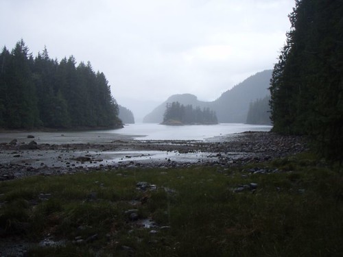
The entrance to the inlet was very narrow and partially blocked by a giant boulder. At low tide there would have been less water and a narrower channel, but the boulder would have been exposed and easy to see. We however were coming in at near high tide, so the boulder was covered by about a foot of water. Tawn took lookout on the bowsprite and I steered the boat around the rock, hugging the oppisite shore as closely as I could. The charts had it marked pretty well so we got past it with no problems.

Once inside the inlet we found Ghost and WindDancer tucked away in a corner of the bay anchored togather. We circled them and got things set to raft up to WindDancers port side.

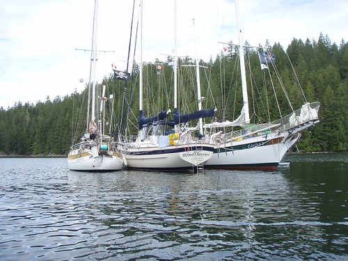
Tied up next to Ghost and WindDancer, Palarran looks so small.

We did some dinghy exploring all around the inlet and into some of the small little coves that were inside the inlet. One of these little coves had a very small entrance. At high tide it looks open, clear and wide. But at low tide their are HUGE boulders that stick up, blocking the entrance. No way to get in by dinghy. We waited till a little after low tide, till more water had come in and dinghied in and spent the afternoon checking out the shoreline and hiking around a small island that was in the middle of the lagoon. On way back out, the tide was REALLY flooding in! It was like being in a whitewater mountain river. We had to be extremly careful, in motoring out, because if we aimed wrong our prop would have hit one of the huge boulders. The amount of water flooding in was amazing. We got out alright, but it was a hell of a ride.

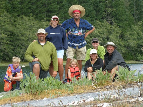
The photo below was taken on the small island we were hiking on. Its all three crews of Palarran, Ghost, & WindDancer. From left to right: Zack, CB, Tawn, Curtis, Ellie, Cynthia, Angie, & Scotty.

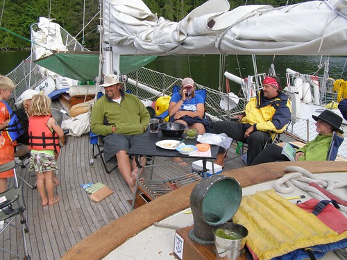
One of the other reasons all got togather again was to have a little B-day party for Angie on Ghost. We had a great dinner onboard Ghost, some booze (of course). Then moved the party over to WindDancer to played some games. We also fired up the laptops and watched all the movies and pictures we each had taken on the trip so far.

The crew of Ghost had to start heading south the next day so they could meet up with Scotty’s mom and Dad in Naniamo, BC. They are retired and are doing the RV thing down in Mexico during the winter and Canada during the summer.

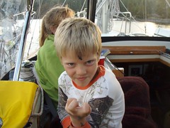
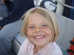
Speaking of the crew of Ghost. Below are pictures of  the rugrats that live on Ghost. Zack & Ellie:

Posted in Adventures, Big trips, Canada Trip, CB, Maps, Palarran | 2 Comments