Big Trip to Canada. Day 3 (CB)

Tuesday July 15th:

Map to the trip is here. The route today is outlined in green.

Ok, today is the day that the “vacation” actually felt like it started. The previous two days were travel days and felt like we were on a mission to get somewhere. Now that we made it, we could slow down and enjoy the sights.

And man, what sights!!

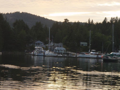
The day started off, with us following Ghost out of Pender Harbor. Winddancer would follow about an hour or so later, as they were going to fill up their fresh water tanks. We motored out of of Pender Harbor and turn north to head up Agamemnon Channel a couple minutes later the wind picked up and we were engines off and sailing.

As we approached Earls Cove there were some ancient Pietraglyphs (sp?) that were painted on the cliffs thousands of years ago and still visible. We could see them with our binoculars, but could not get a good picture with our camera.

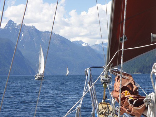
As we were sailing toward Princess Louisa Inlet the wind would follow us around the ‘corners’. If you look on the map of the trip, you can see that the route up is a zigzag of four reaches. Everytime we would come to a new reach, we thought the wind would either die or change directions for the worse on us. But at each turn, the wind would simply follow us around the corner. Or we would flow with it, depending on how you look at it. The distance length wise of these 4 reaches is around 35 miles, but only a mile wide on average. The mountains drop straight down into the water. At one point we sailed right up to the cliff. Or at least within 20 feet of the side of the cliff and the depth sounder was reading over 600 feet of water!! And the cliff shot up another 3,000 feet or more. Unbelievable!! I could almost reach out and touch the wall as we sailed by before we gybed out again. I didn’t think to take a picture straight up.

Actually, none of the picture actually do any sort of justice, but we tried. This pic was taken about a mile or two after we sailed up to the cliff:
The rest of the day only got better. The winds got better and stayed on our stern and built to 20 knots. Just an awesome sail! As we rounded Patrick Point the wind just died. Completly. So we dropped the sails and motored the last mile or two to the begining of Malibu Rapids.

Malibu Rapid is the entrance to Princess Louisa Inlet (follow the link and read the wiki article if you want more info on the inlet) is known and named for the rapids that form when the tides change and all that water is trying to either get in or get out of the inlet. People actually white water kayak on the rapids that form here. No way in hell you could take a sailboat through here, unless you time it just right (Scotty ;P) and go through at just the right time. Which we did.
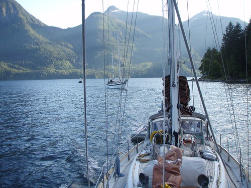
The entrance is only wide enough for one boat to pass at a time. So you have to make a call on the radio to signal your intent to enter and go for it. It is sorta dog legged, so you can see all the way through. Once through though, the scenery is unbelievably more impressive than that of the incredible views we had all day on the way up.

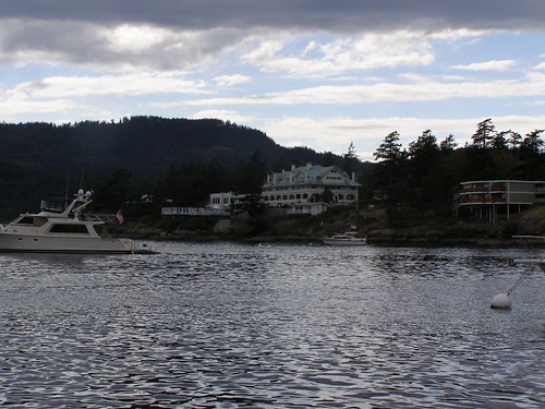
This picture makes it look like there is a lot of room, but just below the surface of the water are huge boulders and the shore that you have to follow a small channel through. You can see Ghost behind us winding thier way in.

The mountains are just as high as the reaches we had been sailing up all day, and drop straight down to the water, but the width of the inlet is 1/4 or less, so the effect is magnified. It’s like being in the bottom of a canyon. And to top it off, at the end of the inlet is Chatterbox Falls.
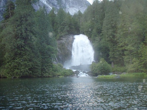
And where did we anchor?
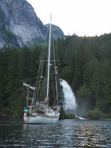
I Love this next picture:
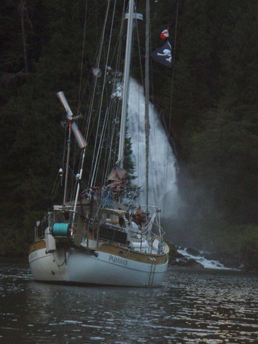
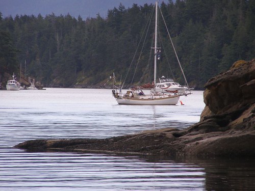
Anchoring there was crazy, we motored right up to the shore. Maybe 20 feet from it, and dropped the anchor in about 25 feet of water. Let out 100 feet of anchor chain and the water flowing out from the falls held us off the shore and pointed just like the picture showes for the 3 days we stayed there.

**{I’ve got a cool video we took of us motoring up to the shore and dropping the anchor. I plan to upload it tonight after work}**

Ok, so the video below is about 5 minutes long and not very exciting. But we started recording as we slowly motored in towards the shore. The camera was mounted on the bowsprite of the boat. The boat you see off to the right is our friends boat WindDancer. When the camera starts shaking and all the rattling is Tawn dropping the anchor and chain overboard.

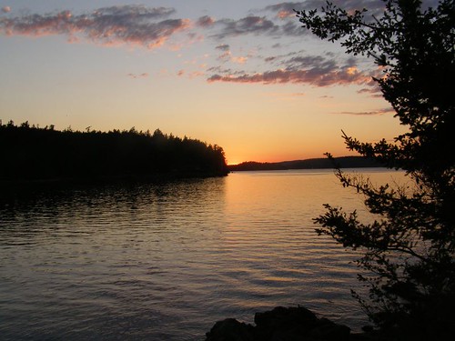
I’m going to just stop even trying to discribe how incredible the scenery here is.

Stay tuned, tomorrow we actually go to shore and walk!!!
Posted in Adventures, Big trips, Canada Trip, CB, Maps, Palarran, Tawn | Leave a comment

Big Trip to Canada. Day 2 (CB)

Monday July 14th:

If your following along on the Map, the blue line is the route for day two.

In order to meet up with Ghost and Winddancer in Pender Harbor, we had another long day ahead of us. If it had not been for the fact that our route was taking us through Porlier Passage we could have gotten up whenever we wanted and just reached our destination a little later. But Slack tide at the pass was at 8:14am, which meant we had to be up and moving by 5am. This is a horribly early time normally, but on vacation it is doubly so.

Our usual plan of attack on early days like this is to get up, start the engine, raise the anchor and get moving. Then while underway we will make B-fast and coffee. That lets us sleep just that much longer. Actually that is the plan on all days, early or not.

The trip through the Gulf Islands was fairly univentful. There was not a breath of wind. But it was sunny and warm, and there was lots to look at. It seemed like a shame to be blasting through without stopping to check out any of the places we were passing by, but we would be coming back this way at the end of the month. So it was’nt too bad.

We got to Polier Passage at about 8:30, so we missed slack tide but the tide was flooding which meant it would be going the same direction we were. Polier Passage is not too narrow, but the amount of water that flows through can get the tide moving up to nine knots at times and the whole passage is littered with hidden rocks. This makes going through at slack water or as close to it as you can a pretty good idea.

Once through the passage and out into the Straights of Georgia the wind was blowing out of the north west at about 15-17 knots. With the pass behind us we decided to do some sailing, even if it meant getting to Pender Harbor a little later than planned.

**{I have video of a small bit of the sailing we did, but I can’t seem to get it edited correctly to post it up here. I’ll work on it and hopefully get it posted soon.}**

We had maybe an hour or two of good sailing, but the wind died just as we reached Thrasher Reef, and with a name like Thrasher Reef, it might be a good idea to have the engine on as we passed through it.

Once on the other side of the reef the wind completly died and left us with a freaking awesome sunny day, but no wind. So with the sails down, we continued north under power.

I can’t recall the exact time we got to Pender Harbor, it must have been about 4-5pm. At any rate we negoiated the narrow rock strewn entrance and found our way all the way back to Garden Bay where we spotted Ghost and Winddancer rafted together. We had spoke with Curtis (from Winddancer) on the radio a little earlier and he let us know they were working on a small engine problem on Ghost and for us to anchor out on our own.

Garden Bay

We circled their raft up, catching up on a few small bits of stuff then proceeded to find a good place to drop the anchor. Garden Bay it’self is pretty small, and at this time of day it was pretty full. The weather forecast was calling for calm weather tommorow, so we decided to anchor outside of Garden Bay in Pender Harbor. Which is still very protected.

Once anchored we dinghied over to the raft up for hugs, handshakes, beers and some catching up. Ghost had been out for 2 weeks already so they had stories to tell and they wanted to hear about our trip up. Winddancer had a few tales to tell as well.

Originally we thought we would stay in Garden Bay for a day and stock up the fridge, but we had loaded up so well in Seattle before we left we only needed a few items (Ice and fresh Veggies). We decided to get up in the morning and head further north.

Scotty, Curtis and myself decided to head to shore to the IGA and get some stuff before dinner. Tommorrow would be about half as long a day as the previous two. We only had one major obsticle to cross. Malibu Rapids. This absolutly had to be crossed at the right time, which was in the evening. So we planned to leaving our around 11am. Which was fine with us, since we were tired of getting up so friggin early.

Posted in Adventures, Big trips, Canada Trip, CB, Maps, Palarran, Tawn | Leave a comment

Almost time for the big vacation.

Been awhile since I posted anything. We have not really been up to awhole lot. A few short trips here or there. Mostly we have been doing boat projects and getting everything taken care of for our big trip this summer.

We are taking off Saturday night/sunday morning at midnight and heading north up into Canada. We will be gone for a month, from July 12th through August 13th.

We are leaving from here and going to Bedwell Harbor to clear into Canadian customs, then the next day heading further north to meet up with friends of our on their boats, Ghost & Wind Dancer in Pender Harbor.  From there we will head up to Princess Louisa Inlet. After that we don’t really have any exact plans for the next 3 weeks. Just going were we feel like going.

If we find some internet connections while we are up there I will post some updates and pictures if we are able. If not I will update as soon as we get back.

Posted in Adventures, Big trips, CB, Maps, Palarran, Tawn | Leave a comment

San Juan’s Trip 2007

To pick up where we left off in the last post, we had left Poulsbo on Sunday morning around 8:30am. This would get us through Agate Passage with a following tide and that tide should carry us most of the way to Port Townsend. The original plan was to continue all the way up to Garrision Bay on San Juan Island in one long day. But there was no wind and the tides worked against us a little, so we decided to stop in Port Townsend on Sunday night. We stayed in Boat Haven Marina and walked into town for a pizza. (Guess, what Cleve likes Olives now!)

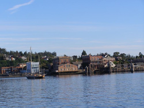
This is the Port Townsend Water front:

Port Townsend

We got up early the next morning and continued the trek north. About half way across the straights of Jaun De Fuca we spotted a friends boat “Gaucho”, he did not see us until I phoned him and got his attention.

Being that it is August there is typically no wind in the San Juans. Today be no exception. We motored almost the entire way. A little sailing early in the AM and a few miles in the Afternoon. We gave up sailing just south of Lime Kiln Point and motored the rest of the way to Garrison bay and dropped anchor. The anchorage was a little more crowded that I thougth it would be, but not too bad.

Hiked around on shore and checked out Britsh Camp, site of famous or not so famous “Pig War”. Which arose way back in the day (1859) between the US and Britian over a border dispute. It got started by an american farmer shooting a british farmers pig on the island. Read all about here if you’d like: Pig War on WikiPedia

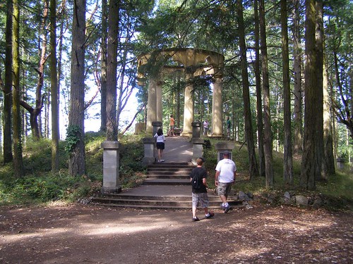
We also dinghied over to Roche Harbor for a stroll around and to stretch our legs, and to prove it, Tawn took a picture of me and Cleve walking. The columns in the picture are of some old ass millionaire idea of a picnic area or something?? It’s called The Mousolium…whatever:

Walking

The next day found us on Stuart Island, on a mooring ball in Ried Harbor. The main attraction of Stuart Island is the Turn Point Light house. It’s a 2 or 3 mile hike from the anchorage. We made Cleve do it anyway. :) So much for tough wanna be Marine! :P

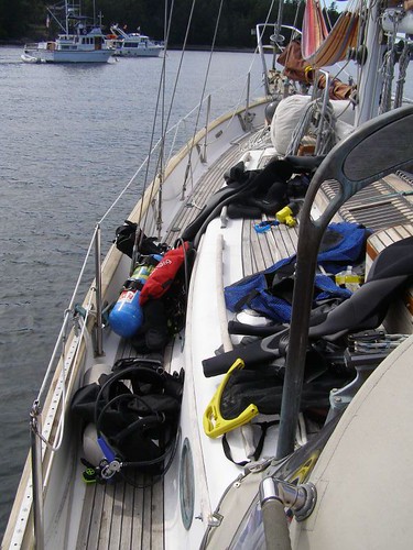
We left Stuart island and headed for Tawn’s favorite anchorage in the San Juans. Blind Bay, which is on Shaw Island. This is the site of the famous A.R.E, in which Me, Scotty, Dave and Rich dove to retrieve Scotty’s stuck anchor from last years trip. Me and Tawn also did a dive on the same boat this time as well:

Scuba gear on deck

We also took some picutres underwater as well, but have not gotten those developed yet.

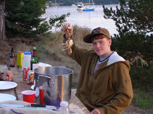
Blind bay is also the site of me and Tawn’s favorite vacation tradition. Sitting at the mouth of the bay is a small island, Blind Island. The tradition is simple enough but fun. First you have to have set out the crab traps and have caught a crab or two. Once the crab is caught, we dinghy ashore with booze and the makings for a Low country Boil and a large pot to cook it all in.

Eat your crab and enjoy the sunset:

Boil sunset blind bay

We spent the next night tied to one of the Mooring balls at Rosario resort. This was pretty fun. The resort is an old school resort, it totally reminds me of the resort in Dirty Dancing. I kept expecting to see Patrick Swayze and Baby practicing somewhere. Never did though, and remember “NOBODY puts Baby in a corner!”. We made good use of the Swimming pools, hottubs and bar while we where there.

Here is a really bad picture of the resort:

Rosario resort

The next 2 days we spent at Sucia Island. This is in our opinion the best spot in all of the San Juans. It’s remote, no one around. Cool hiking, camping and fishing. We did lose one of our crabpots though. That sorta sucked. We hiked all over the island and caught some rock fish for dinner one night. Actually, Cleve caught them. I did’nt catch anything.

Echo Bay

We decided to give Cleve a break and head back to Friday harbor for some civilization. We tied up in front of the customs dock and they let us stay there for the night. We checked out the town, at some chinese food, and went to a movie. The next day was an early one, due to the long trip we had planned and we wanted to time the tides right.

With absolutly on wind we left Friday harbor around 7am and motored all they way back to Port Ludlow where we anchored for the night. Port Ludlow is boring! Very boring…not sure why everyone always raves about it? Not that I don’t mind a nice chilled out anchorage, but I’ve always heard from my boating friends that Port Ludlow is a great place to go and lots to do there. It was very scenic, except for all the apartment complexes on shore, but there was nothing on shore to do, maybe we missed something? Not sure, probably won’t go back to find out. Of course, I say the same thing about Mackaye Harbor on Lopez Island as well. It’s a nice place but nothing to do and I won’t go back. When in reality, both of these harbors are actually pretty cool places, but both have the unfortunate honor of being the last place we stopped on our last night of vacation. This seems to leave a stink on a place for me.

Anyway, as we were on the last leg home and only a few miles from the marina, I spotted our friends Bob, Sheri and thier girls (and Tabor). They had been using our slip for the last couple weeks and were headed north for a month on their own vacation. We bobbed in the middle of the sound for a few minutes and caught up, then they headed north and us south to home.

BOO! The End.

Oh and as usual, i’ve include a crappy little map of the trip.


View Larger Map

Posted in Adventures, Big trips, CB, Maps, Palarran, Tawn | Leave a comment